
Prototype · not shown to visitors
Ordnance Survey free data for a home
What OS's three free APIs add for one home: OS Linked Identifiers (its street and building references), OS Names (the places around it) and the OS Features OpenData layers (roads, railways, pylons, water, woodland and sites around it). The home is the OS address point nearest the postcode's centre unless a UPRN is given.
The home
- UPRN 200002936771 · 1 m from the postcode centre
- British National Grid 300954, 195274 · 51.647512, -3.432926
Its street and building (OS Linked Identifiers)
- Official street (USRN): 47402371 · Designated Street Name · 21 m from the home
- OS building or plot outline (TOID): osgb1000023712139
- Road link (TOID): osgb5000005186093026
- OS's links as at 2016-02-10
Use in the report: the home's street by OS's own reference, not by matching HM Land Registry's address text; the roof and plot checks on the outline OS links to the address, not the nearest one.
The places around it (OS Names)
| Kind | Nearest within 1 km | Distance | Borough |
|---|---|---|---|
| Street | Brynbedw Road | 151 m | |
| Neighbourhood | Stanleytown | 539 m | |
| Village | Tylorstown | 373 m | |
| Hamlet | – | ||
| Town | – | ||
| City | – | ||
| Other settlement | – |
Use in the report: name the neighbourhood the home is in ("in Hither Green, Lewisham") in headings and the summary.
Around it (OS Features: OS Open Zoomstack)
| What | Nearest within 1.5 km | Distance | Searched within |
|---|---|---|---|
| Electricity transmission lines (pylons) | none within 1.5 km | 1.5 km | |
| Main roads (national road layer) | none within 1.5 km | 1.5 km | |
| Other main roads (regional road layer) | East Road (A Road) | 55 m | 150 m |
| Railway lines | none within 1.5 km | 1.5 km | |
| Railway stations | none within 1.5 km | 1.5 km | |
| Rivers, lakes and ponds | (Local) | 196 m | 500 m |
| Streams and drains | (Local) | 122 m | 150 m |
| Woodland | (Local) | 27 m | 150 m |
| Green space | (Religious Grounds) | 19 m | 150 m |
| Schools, hospitals and other sites | (Education) | 110 m | 150 m |
| Airports | none within 1.5 km | 5.0 km | |
| The coast (foreshore) | none within 1.5 km | 5.0 km |
Use in the report: distance to pylons, motorways and A roads and railway lines for buyers; nearest water, woodland and green space. Zoomstack is a simplified, small-scale dataset: distances are indicative, to tens of metres.
Named sites within 1 km (OS Names)
| Kind | Nearest within 1 km | Distance |
|---|---|---|
| Chemical works | None within 1 km | |
| Oil refinery | None within 1 km | |
| Oil terminal | None within 1 km | |
| Oil storage | None within 1 km | |
| Gas storage | None within 1 km | |
| Power station | None within 1 km | |
| Electricity substation or grid site | None within 1 km | |
| Airfield | None within 1 km | |
| Heliport | None within 1 km | |
| Hospital | None within 1 km | |
| Hospice | None within 1 km | |
| Railway station | None within 1 km |
Use in the report: industrial and utility sites near a home (chemical works, oil and gas storage, power stations, substations), airfields and heliports, the nearest hospital. OS Names searches 1 km at most; wider needs the OS Open Names download.
Named features near it (OS Open Zoomstack names)
| Kind | Nearest | Distance |
|---|---|---|
| Greenspace | Holy Trinity Church | 35 m |
| Sites | Ysgol Gynradd Pendyrus/Tylorstown Primary School | 137 m |
| Woodland | Coed Cynllwyn-du | 333 m |
Urban area: inside a large built-up area.
Use in the report: the nearest river by name ("the Ravensbourne River, 400 m"), the nearest named wood, common or hill; whether the home is in town or country.
Ground hazards (BGS GeoSure 5 km hex grid)
BGS's file is not held on this machine (var/os-prototype/).
The building (OS NGD Buildings, premium)
Not available: the key cannot reach OS NGD API – Features. It needs a key from a project inside the OS Data Hub organisation on the Premium plan (the £1,000 a month credit), set as os_data_api_key. Then this panel shows the home's building with every attribute OS holds: floors, basement, roof shape and aspect, roof material, solar panels, green roof, age, construction material, height and use.
Premium data: £0.19 a request inside the Premium plan's free £1,000 a month; OS's terms allow showing it and caching it for 24 hours (kept here 24 hours), not storing it in a saved report without OS's written permission. Contains OS data © Crown copyright and database right.
Boundaries (ONS) and further afield
- Council: Rhondda Cynon Taf (W06000016)
- Ward: Tylorstown and Ynyshir (W05001113)
- Parish or unparished area: Tylorstown (W04000709)
- Parliamentary constituency: Rhondda and Ogmore (W07000107)
- Neighbourhood (MSOA): Rhondda Cynon Taf 013 (W02000264)
- Small area (LSOA): Rhondda Cynon Taf 013D (W01001276)
- Nearest motorway (OS Open Zoomstack): M4, 14.7 km
- Coast (BGS GeoCoast): no coastline within 2 km
Source: Office for National Statistics licensed under the Open Government Licence v3.0. Contains OS data © Crown copyright and database right. Parish and constituency are new to the report; the council and 2021 areas match what it already uses.
OS vector map: colour schemes and OS's own boundaries
OS's National Geographic Database as vector tiles: every layer can be recoloured. OS's own styles and three of ours on the same data, and OS's boundaries as outlines.
OS NGD Vector Tiles (ngd-base and the administrative boundaries, free on the OpenData plan) through the server, so no key reaches the browser. Contains OS data © Crown copyright and database right.
Map: OS styles and layers to choose from
OS Maps API tiles (zoom 7 to 20) through the server, so no key reaches the browser; boundaries from ONS; the building, plot, garden and postcode outline from OS NGD. OS's vector boundary tiles (OS Vector Tile API) need that API added to a key's project.
The lie of the land (Natural Resources Wales LiDAR ground)
- The plot's slope: 21.7% (6.5 m across the 15 m round the home), downhill to the east
- A hollow or a rise? The home's ground is 209.1 m above sea level; at 25 m round it the ground averages 209.33 m (50% of it lower than the home); at 50 m round it the ground averages 209.44 m (50% of it lower than the home); at 100 m round it the ground averages 212 m (50% of it lower than the home); the home sits in a hollow.
- The lowest ground within 50 m: 14.85 m below the home, 50 m away
- Where rain runs: from the home it heads north-east, 139 m, falling 15.66 m, and gathers in a low spot (drawn in blue in the 3D view).
Bare earth: walls, kerbs and drains are not in it, so this is the shape of the land, not a flood model. Environment Agency LIDAR Composite DTM and first- and last-return DSM, 1 m (England): © Environment Agency copyright and/or database right, Open Government Licence v3.0.
The view from upstairs (worked out from the LiDAR)
- From a window 4.3 m up (213.2 m above sea level), over roofs and trees, to 500 m:
- A park or green space: in sight, nearest 18 m to the east
- Water: not in sight
- The railway: not in sight
- A main road: not in sight
- A tall building (15 m or more): in sight, nearest 142 m to the east
- The longest view: 296 m to the east
Hover over the rose or a line above to see where it is; click to look that way from the window in the 3D view below. Our own sight lines every 3° across the EA's first-return surface on a 4 m grid, matched to OS Open Zoomstack (parks, water, railway, main roads) and the LiDAR (tall buildings). A window's real outlook depends on which side it is on and on what grows.
Noise and things you may not want nearby
Modelled noise at the home (Defra's strategic noise maps, 2022, a day–evening–night average): road day ; road night ; rail day ; rail night
| What | Name | Distance | Source |
|---|---|---|---|
| Motorway | M4 | 14.7 km | OS Open Zoomstack |
Waste sites and large installations: the Environment Agency's public registers (England; our weekly copy; sewage works only while the discharge register's terms allow). Railway, main roads and pylons are drawn in the 3D view with their distances.
The home in 3D on LiDAR: OS buildings on Natural Resources Wales's ground and roofs
The ground is Natural Resources Wales's 1 m LiDAR terrain; each OS building outline is walled to its eaves and roofed with the LiDAR surface inside it (real ridges and dormers). Above the ground outside OS's outlines, the LiDAR's last return tells trees (green: the laser got through) from solid things: grey where a building's roof runs past OS's outline, brown where OS has no building at all. Roofs OS records as having solar panels carry dark panels, and green roofs are green. The home is orange. Drag to turn, shift-drag to move, scroll to zoom, click anything for what it is.
Flooding follows FloodRadar's 3D prototype in our own code: pick one of Natural Resources Wales's flood maps to drape it on the ground, and raise the river with the slider. Water spreads only from a river or lake in the box, over ground, floors and defence crests lower than it; buildings turn orange when water reaches their walls and red when it is likely inside (floors assumed 15 cm above the ground). The marks on the slider are the Environment Agency's depth bands at the home and the nearest gauge's record.
This home: dry
- Reading Natural Resources Wales's flood maps…
Welsh Government and Natural Resources Wales LiDAR 2020-22, 1 m DTM and DSM (DataMapWales), Open Government Licence v3.0. OS NGD buildings, their solar panels and green roofs (premium, kept 24 hours; where the panels sit on the roof is our guess). Contains Natural Resources Wales information © Natural Resources Wales and database right (Flood Map for Planning, areas benefiting from defences, recorded flood outlines, defences, permits, river levels); Welsh Government disused coal tips (March 2026); National Grid and WPD (now NGED) lines as held by DataMapWales. Contains OS data © Crown copyright and database right. The river rise is a what-if on the LiDAR ground, not a forecast: it ignores drains, flow and timing, and the Environment Agency's maps are the assessment. The model follows FloodRadar's 3D prototype. England only.
Businesses within 500 m, and what is new
13 food businesses on the Food Standards Agency's register (our copy since 16 Sep 2026): 0 new or awaiting their first inspection (usually just opened), 0 gone from the register since.
Every food business, nearest first (13)
- Rhondda Foodbank (other retailer, 70 m)
- Caffi Croeso (restaurant or café, 71 m)
- Tylorstown Welfare Hall & Institute (pub or bar, 97 m)
- Tylorstown Ex Servicemens Club (pub or bar, 97 m)
- Munchies (takeaway or sandwich shop, 97 m)
- Tylorstown Primary School (school or college, 110 m)
- Little Ferns Tylorstown (care or childcare, 110 m)
- Jim's Garden Fish & Chips & Chinese Takeaway (takeaway or sandwich shop, 143 m)
- Somethings Cooking (other food business, 143 m)
- Bailey's Burger Bar & Dessert Parlour (takeaway or sandwich shop, 150 m)
- Londis (other retailer, 177 m)
- Lidl (supermarket, 223 m)
- Mayfair Garden (takeaway or sandwich shop, 322 m)
Other places OpenStreetMap maps within 500 m (2)
- Café (1): Welfare Hall Cafe
- Supermarket (1): Lidl
Food Standards Agency food hygiene register (our weekly copy; ratings are never shown), Open Government Licence; OpenStreetMap © OpenStreetMap contributors. "New" is new to our copy of the register, so it fills in as the weekly copies build up; empty and disused shop units are as volunteers mapped them. All on the map below as a layer.
Ideas from OS's developer blog
On your way to the station
Nothing recorded within 80 m of the straight line to the station.
Where places cluster within 1 km
- Cafés: 1 of 1 in one 200 m square, about 140 m north-east
- Restaurants: none recorded
- Pubs: none recorded
- Food shops: none recorded
"On your way" follows OS's "Get Pret Go": places ranked along the straight line from the home to its nearest station (a straight line, not a walking route). The clusters follow its blue plaques tutorial. Both read the report's own OpenStreetMap table (© OpenStreetMap contributors).
Ground under it (British Geological Survey services)
- Mining, other than coal (1 km hexagon): NA: No known record of mining activity.
- Bedrock: South Wales Upper Coal Measures Formation (Mudstone, siltstone, sandstone, coal, ironstone and ferricrete)
- Surface deposits: None mapped (bedrock at the surface)
- Recorded landslides within 1.0 km: 15 · nearest 430 m
- Recent earthquakes within 25.0 km: 149 · nearest 2.7 km
- Borehole records within 250 m: 2 · nearest 234 m (Ferndale Colliery Gynllwyn-du North No.9 Pit, scanned log held)
GeoSure from BGS's own service (a check on the file above): Clay that shrinks and swells Low; Landslides Significant; Compressible ground (soft ground that settles) Low; Collapsible ground Low; Soluble rocks (sinkholes) Low; Running sand Low;
Contains British Geological Survey materials © UKRI. BGS GeoIndex hex grids service and BGS OGC API (beta), Open Government Licence v3.0; BGS gives no warranty as to the quality, accuracy or completeness of its free map data. Use in the report: the mining hazard (south-east London's old chalk mines show here), the rock and soil under the home in plain words, and for surveyors the number of BGS borehole logs nearby.
More hazards (Wales)
Checks beyond the report's, from each nation's own publisher, kept as long as the publisher's answer lasts: a year for maps, a month for lists of sites and sightings, 15 minutes for river levels.
Invasive plants (sightings within 1 km)
| Japanese knotweed | 2 sightings | Nearest 294 m (2009), placed to about 71 m; newest 2024 at 757 m |
| Hybrid knotweed | None recorded | |
| Himalayan balsam | 1 sighting | Nearest 709 m (1997), placed to about 7 m |
| Giant hogweed | None recorded |
NBN Atlas occurrence records (each record under its own data resource's licence). Sightings, not a survey: none recorded is not proof of none.
Reservoir flooding (if a dam failed)
| Inside a reservoir flood extent | No | Natural Resources Wales's maximum extent for its 197 large raised reservoirs. |
Environment Agency Reservoir Flood Extents (dry day and wet day), Natural Resources Wales Flood Risk from Reservoirs, SEPA reservoir register: OGL v3.
Coastal erosion (nearest coast within 2 km)
| Coastal erosion | No mapped coast within 2 km |
Environment Agency National Coastal Erosion Risk Mapping 2024; Natural Resources Wales coastal erosion and Shoreline Management Plan policies; Dynamic Coast (NatureScot and partners), high emissions. OGL v3 or as published.
Hotter summers (Met Office projections for this 12 km square)
| Days over 30°C a year | 1.4 now | 1981-2000: 0.2; with 2°C of global warming: 2.4; with 4°C: 10.7 (8 to 20.3) |
| Days over 35°C a year | 0 now | 1981-2000: 0; with 2°C of global warming: 0.2; with 4°C: 1.5 (0.8 to 4) |
| Days over 25°C a year | 14 now | 1981-2000: 6.8; with 2°C of global warming: 20.7; with 4°C: 41.7 (36.9 to 56.9) |
| Tropical nights (staying above 20°C) a year | 0 now | 1981-2000: 0; with 2°C of global warming: 0.1; with 4°C: 2.4 (1.2 to 3.6) |
| The hottest day of a summer, on average | 29.6°C now | 1981-2000: 27.7°C; with 2°C of global warming: 31.2°C; with 4°C: 34.7°C |
Met Office Climate Data Portal, UKCP18 12 km projections (median, with the range across the model runs), Open Government Licence v3.0. Warming levels are above pre-industrial; the world is at about 1.3°C now.
Major-hazard (COMAH) sites within 3 miles
| COMAH establishments | None within 3 miles | Sites holding enough dangerous substances (chemicals, fuels, explosives) to fall under the Control of Major Accident Hazards Regulations. |
Health and Safety Executive, COMAH 2015 public information search (establishments within 3 miles of the postcode). Tier and site details as HSE publishes them.
Flooding: more from Natural Resources Wales
| Flood Map for Planning: rivers | Outside Zones 2 and 3 | With climate change allowances, ignoring defences (Zone 3: 1% a year or more from rivers and surface water, 0.5% from the sea; Zone 2 down to 0.1%). |
| Flood Map for Planning: the sea | Outside Zones 2 and 3 | With climate change allowances, ignoring defences (Zone 3: 1% a year or more from rivers and surface water, 0.5% from the sea; Zone 2 down to 0.1%). |
| Flood Map for Planning: surface water and small watercourses | Outside Zones 2 and 3 | With climate change allowances, ignoring defences (Zone 3: 1% a year or more from rivers and surface water, 0.5% from the sea; Zone 2 down to 0.1%). |
| Area benefiting from flood defences | No | |
| Recorded flood outlines over the home | None recorded | |
| Flood defences within 500 m | None mapped |
Contains Natural Resources Wales information © Natural Resources Wales and database right (Flood Map for Planning, areas benefiting from defences, recorded flood outlines, defences, permits, river levels); Welsh Government disused coal tips (March 2026); National Grid and WPD (now NGED) lines as held by DataMapWales. Contains OS data © Crown copyright and database right.
Disused coal tips within 1 km (Welsh Government)
| Tip T43612, category A | 252 m | Category A: least likely to need attention; last inspected 21/08/2025; Rhondda Cynon Taf |
| Tip T48519, category B | 482 m | Category B: low potential to affect people or property; last inspected 07/08/2023; Rhondda Cynon Taf |
Welsh Government, disused coal tips in Wales (all categories, March 2026), through DataMapWales. Categories are about how often a tip is inspected, not a prediction of failure.
River levels (Natural Resources Wales)
| Nearest gauge: Rhondda at Gelli, 3.2 km | 0.06 m | At 9 Nov 03:00 UTC; typical range 0.00 to 0.53; highest on record 2.29 (2007-12-06) |
Natural Resources Wales, Rivers and Seas (river levels every 15 minutes; kept 15 minutes here). Contains Natural Resources Wales information © Natural Resources Wales and database right.
Permitted and landfill sites within 500 m (Natural Resources Wales)
| Sewage or trade discharge | 209 m | R/O Tylorstown Primary School CSO, Tylorstown · Sewage - Water Undertaker into Afon Rhondda Fach (AN0350501) |
| Sewage or trade discharge | 243 m | CSO OPP 37 EDMONDES ST TYLORSTOWN · Sewage - Water Undertaker into THE RIVER RHONDDA FACH (AN0350101) |
| Sewage or trade discharge | 374 m | East Rd CSO Tylorstown · Sewage - Water Undertaker into RHONDDA FACH RIVER (AN0119001) |
| Sewage or trade discharge | 374 m | JUNCT OF BRONDEG AND PENRHYS ST CSO · Sewage - Water Undertaker into THE RHONDDA FACH RIVER (AN0117701) |
| Sewage or trade discharge | 438 m | Ferndale Road CSO Tylorstown RCT · Sewage - Water Undertaker into River Rhondda Fach (AN0350301) |
Contains Natural Resources Wales information © Natural Resources Wales and database right (Flood Map for Planning, areas benefiting from defences, recorded flood outlines, defences, permits, river levels); Welsh Government disused coal tips (March 2026); National Grid and WPD (now NGED) lines as held by DataMapWales. Contains OS data © Crown copyright and database right.
Power lines (Wales)
| National Grid 275 and 400 kV lines within 1 km | None | |
| 11 kV overhead lines within 250 m | Nearest 167 m | WPD (now National Grid Electricity Distribution) open data as of March 2021, South and mid Wales only; North Wales (SP Energy Networks) is not open. |
Contains Natural Resources Wales information © Natural Resources Wales and database right (Flood Map for Planning, areas benefiting from defences, recorded flood outlines, defences, permits, river levels); Welsh Government disused coal tips (March 2026); National Grid and WPD (now NGED) lines as held by DataMapWales. Contains OS data © Crown copyright and database right.
OS's free map styles (OS Maps API, OpenData zoom levels)
The report uses Light today. Road and Outdoor are free at the same zoom; the home is in the centre tile.
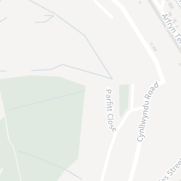
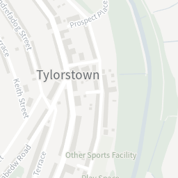

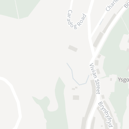
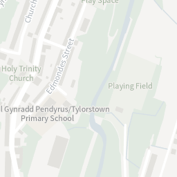
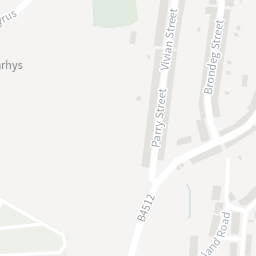
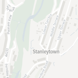
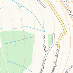
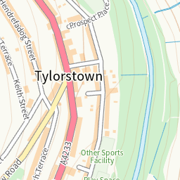
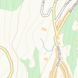
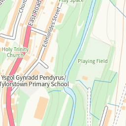
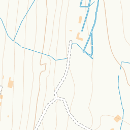
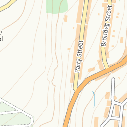
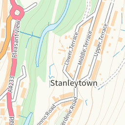
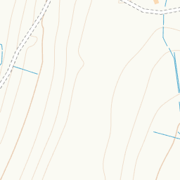
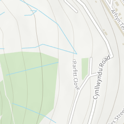
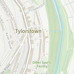
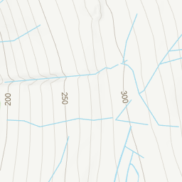
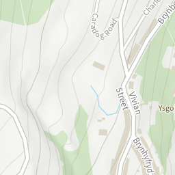
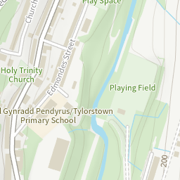
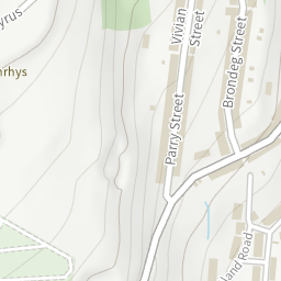
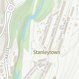
Contains OS data © Crown copyright and database right. Zoom 17 and closer is premium. These tiles use the map key the live site already sends to browsers (os_maps_api_key); the data APIs above use os_data_api_key when set.
Contains OS data © Crown copyright and database right. OS Names API, OS Linked Identifiers API and OS Features API (OS Open UPRN, OS Open TOID, OS Open USRN, OS Open Zoomstack), Open Government Licence v3.0. Not available on the free plan: OS NGD API – Features (building floors, basement, roof, age), OS Places API (addresses).